“Handline Vessel Oleada, your transit has been cancelled.”
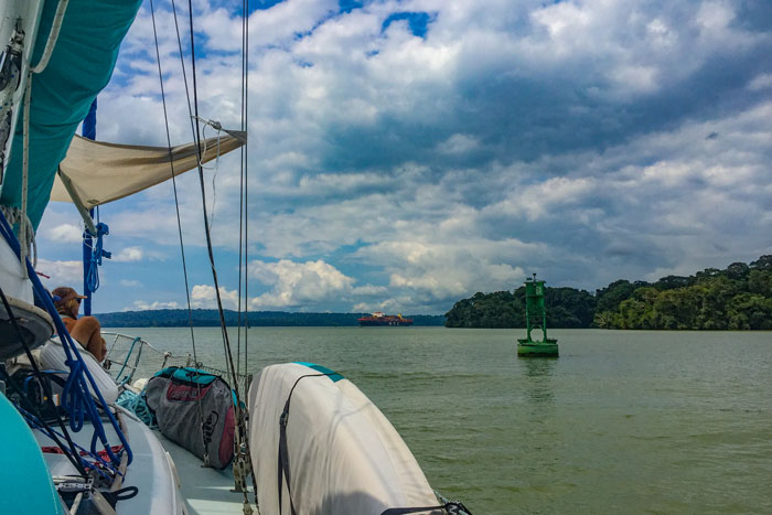
It’s 5:00 am, and our sailboat bobs around in the choppy entrance to the busiest shipping channel in the world. We are on the Pacific side of the Panama Canal, and we have spent the last two weeks securing everything we need to pass through the canal today. Our caffeinated crew we recruited for the transit stare in shock at the radio.
“Cancelled?” Josh asks incredulously into the VHF, repeating the word to the Flamenco Signal Station radio operator. This one station coordinates the entrance and exit of sixty percent of the world’s shipping traffic. Josh talks on the radio as I nervously hold the wheel. The water is black and sharply reflects the lighting glaring from the steep sides around the canal entrance, disorienting me in the peaked water swirling under the sixteen foot tide.
“That’s correct Oleada.”
Josh pauses. “Can you tell us why?”
A long silence, then, “I have no more information at this time.”
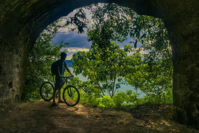
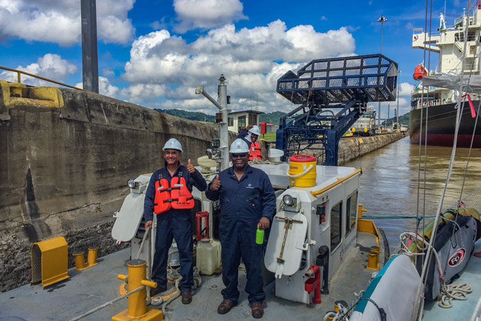
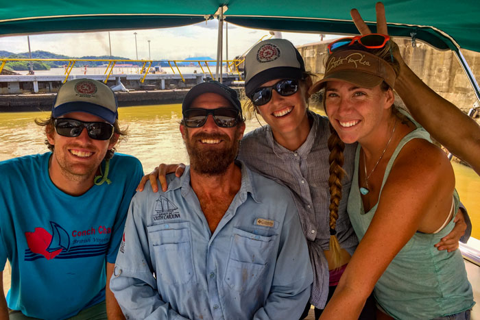
With neither recourse nor answers, we turn Oleada around and head back toward the anchorage on the other side of the signal station. At first light, I make breakfast through bleary eyes for our friends who have volunteered to be ‘line handlers’ (hence our moniker as a ‘Handline Vessel’) for our sailboat. We need four people, two for each side of the boat, where we will use thick rented lines to attach our tiny ship to the sides of the canal. We need handlers as turbulent waters fill and drop in the lock chambers which raise and lower our boat from the manmade freshwater lake that spans this isthmus and allows us to skip sailing around South America. We would have picked up an ‘advisor’ this morning as well, a canal employee who instructs the captain at every step for safe passage in the fifty-four mile, six lock shuffle alongside the largest ships in the world. (As it turns out, this was the reason our transit was cancelled: our advisor was a no-show.)
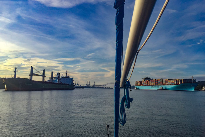
A quick pan around our boat when we approached the Pacific side of the Panama Canal a few days earlier. Scores of container ships wait for their documentation to be able to pass.
As we check in with the signal station throughout the day to receive a new departure time for the following morning, I begin to realize that getting our little sailboat through the canal is like landing a Cessna at JFK International: we are subject to the vagaries of weather, much bigger boats, and personnel scheduling. It all must be coordinated by one station that serves as the equivalent of air traffic control. Finally, we’re told our departure time the next morning will be 2.30am.
2.30am? I acquiesce, and promise to continually call both the office and the signal station for updates at their recommended times: 8pm and 12am. These call schedules are designed for ships with more than two people on board, I surmise. But we don’t want to miss our shot at passing through one of the greatest engineering marvels of humankind.
The U.S. completed the Panama Canal in 1914, and the project, over one hundred years later, seems impossibly prescient. The canal has always been a marvel not just of engineering but of tenacity, given the conditions that the builders faced: jungle hazards, nearly year-round torrential rains, and tropical disease.
So how will this wonder, which relies on antiquated equipment, deal with the new threats posed by climate change?
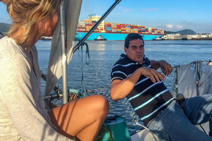
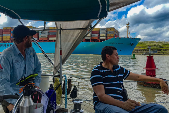
The following early morning, we wait in the dark and the air hangs heavy with sea mist and anticipation. Our advisor, Harold Eldemire, a hulking Panamanian with a pensive gaze and unexpected acerbic wit, steps on board from a Canal Authority tugboat in the pitch black. I offer him coffee as he directs us to take the boat forward hard under the Bridge of the Americas. Our top speed is between six and seven knots, and when Harold directs us to move faster, Josh smiles apologetically and the advisor shrugs ambivalently. He knows that if we follow his instructions, he can get us through.
After steaming for two tense hours into the dawn, we must wait for our container ship at the Miraflores lock; they won’t fill the locks only for a sailboat. Harold, relaxing now that he can sense our desire to work with him, begins regaling us with stories from the canal.
The American West Extends to the Sea
The canal is easy to take for granted now, but this project, started by the French and finished by the Americans, took 44 years to complete. Driven by bold political risk-taking, brilliant design and execution bred largely by the US railroad industry, the endeavor also required heavy capital investment in the methodical removal of yellow fever mosquitoes.
But it all started with an idea of empires. Historian David McCullough notes that Theodore Roosevelt’s commitment to the canal had its roots in The Influence of Sea Power, published in 1890—the same year that the Census Bureau declared there was no longer any land frontier. Roosevelt “had a vision of his country as the commanding power on two oceans, and these joined by a canal built, owned, operated, policed, and fortified by his country. The canal was to be the first step to American supremacy at sea.”
In our current political climate, it’s hard to imagine a time where the Sea Power’s author, Alfred Thayer Mahan, could declare that the US had thus far been too happy to wallow in its own abundant natural resources. He urged that the US charge into the blue unknown.
As Oleada waits at the gates to the interior of the continent, I tried to imagine this manifest destiny charge into the jungle hidden before us.
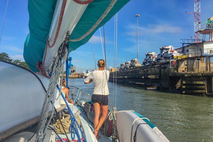
Josh and I take turns holding the boat steady in the swirling tidal waters of the Pacific, a mentally taxing job at the beginning of what I know will be a very long day. Finally, our companion ship arrives, steaming purposefully into the lock. We squeak quickly in behind, tying to a Canal Authority workboat that looks like an awkward snowplow on the water. I hurry to adjust the black car tires hanging from our rail as fenders that give our boat added protection and a decidedly trash-pile appearance. I shift the tires to sit lower and against the rail of the snowplow boat, moving as quickly as I can—the locks won’t wait for us to get everything right. Two sets of hulking iron doors begin to swing close only a few feet off our stern.

Harold admires aloud the safety built into these locks, and narrates his praise: two doors always close in case one fails; the doors close in a v shape to reduce pressure, preventing them from blowing open. Powered by electricity, if there were any failure, the doors could be cranked open and closed by hand. As soon as the doors seal closed, water boils up from the bottom of the locked chamber. The movement of green water reminds me immediately of the opaque, swirling waters of the Colorado River in flood. Oleada jerks hard on her stern line, but she’s firmly tied to the little tug next to us, which is tied to the wall. It’s hard to believe this system is over one hundred years old and still works so well.
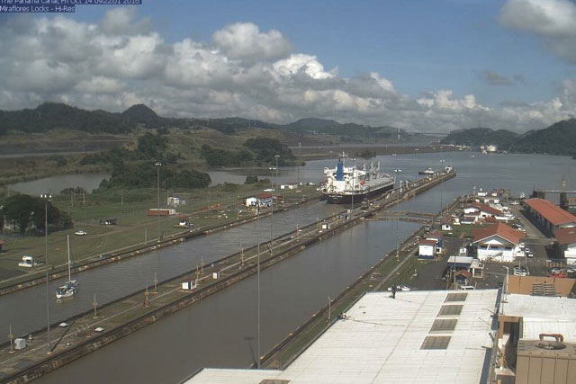
Going up: the Miraflores locks fill as Oleada rises above the Pacific.
It only takes us about ten minutes to ascend to the top of the chamber, then we shuffle forward into the second chamber of this lock. The swirling water isn’t nearly as dramatic this time. As it slows, then stops, the front gates open unceremoniously. We charge to the next lock about a mile away. These locks were built a safe distance apart: if one lock fails, the entire Gatun Lake won’t drain into the Pacific.
The plow barge that accompanied us through the locks speeds away through the brown waters around Culebra Cut.
We motor the mile across Miraflores Lake in quick pursuit of our companion ship, and we make fast to the same tug in the lock. The gain in elevation isn’t as high or dramatic, but when we’re through we emerge at lake level in fresh water, 85 feet above sea level. We now have fifty miles of lake to cross in as little time as possible. Over the next five hours, Josh pushes our little fifty horsepower diesel motor harder than I have ever heard him run it.
The wind fills in and quickly clocks around to meet us on the nose, slowing our progress. The day is strangely bright and cloud-free in for the rainy season. We ask Harold if we can raise a sail, but he tells us a few years ago a sailboat ran into one of the massive mooring buoys on Gatun Lake, so no sailing allowed now. Josh throttles up even more, and Oleada plows forward obediently. If our advisor determines that we move too slowly, or if we have some sort of engine failure that causes us to slow down, we must sacrifice at least a thousand dollars in pre-paid fees.
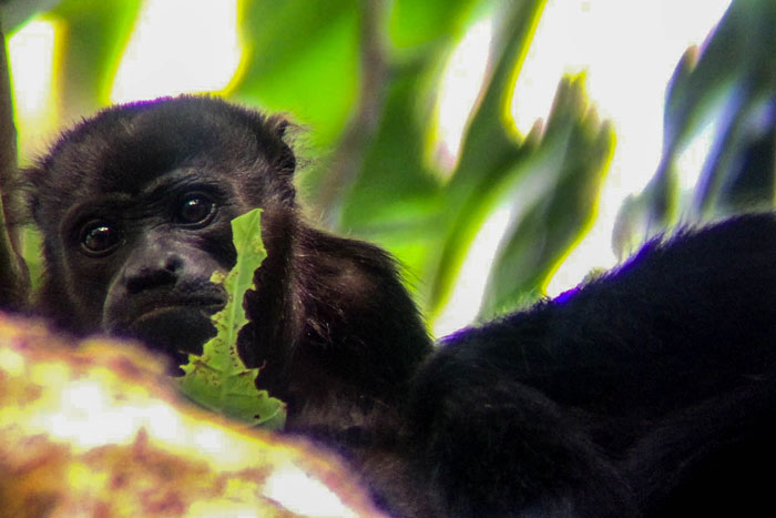
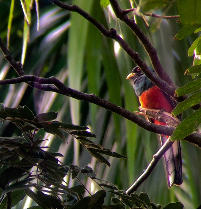
As we pass into Culebra Cut, the gateway to Gatun Lake and arguably the most difficult job completed during canal construction (aside from the politics,) I see a crocodile swish quickly towards the banks of the cut, then disappear in a dissolve from the surface. The wildlife hints at the still-wild jungle we’ll soon see lining Gatun’s banks.
This is the first time that Oleada has ever been in fresh water, and she plows through a little bit lower, displacing more water and slowing us down even further. It’s an amazing sensation to know our boat so well that I can feel this subtle change.
Culebra Cut opens into a clear, wide expanse ringed with green, and we begin our crossing of Gatun Lake, the manmade reservoir that serves as the entire reason the canal can support the world’s modern ships.
To Lock or Not to Lock: Creating a Lake
The canal started ambitiously, but with surprising uncertainty. One of the greatest challenges was choosing the site. Despite the abandoned French efforts in Panama, or perhaps because of them, which took $287 million and 20,000 lives in the course of a decade, a few powerful and outspoken US politicians lobbied hard for a Nicaraguan canal. The main point of contention in those earlier days was whether any canal could be constructed entirely at sea level, without locks. In Nicaragua, this appeared more feasible. However, behind-the-scenes advocates for Panama, the Frenchman Phillippe Bunau-Varilla and American William Nelson Cromwell, managed to sell the French progress on the canal to the US in 1904. They cited the unpredictable volcanic activity of Nicaragua and the newly minted sovereignty of the country of Panama from Colombia.
Even after Panama was chosen over Nicaragua, the debate over a sea level or locked canal continued. It’s easy to see in hindsight that a sea level canal would have been impossible. But the distance from the US and the inconceivable denseness of the jungle clouded judgements.
For over thirty years, engineers and politicians ignored the lock option, which required damming the outrageously powerful Chagres River. After years of bickering, the US Congress voted in 1906 to make it a locked canal—a decision that would still be questioned for years to come, largely because most people could not grasp the conditions faced by engineers and workers who stood facing the jungle-choked Continental divide on the spine of this tiny country.
Quickly thereafter, the indigenous community at Gatun saw the deposition of rock and earth begin. The trees cut to dam the Chagres river were so large they had to be tackled with dynamite, one of the most dangerous operations in the building of the canal. Survey parties sent to map the perimeter of the lake through unbroken jungle were away for a year at a time, cutting their swaths by hand. The largest artificial lake in the world to that date would submerge 164 square miles of jungle, an area the size of Barbados.
With crocodile escorts, we approach this freshwater expanse, pulling to the side of narrow Culebra Cut to allow the towering container ships to pass until we reached this lake. Earth moving machines still operate constantly on Culebra’s banks in an attempt to stem the tide of mud. But the lake opens magically from these precarious slopes, an unperturbed jungle. Even today, the area surrounding the lake holds some of the most pristine jungle in the Americas, where wild jaguars live like they did hundreds of years ago. The Smithsonian Tropical Research Institute bases itself here to examine how the complex jungle community thrives. Slicing through the lake, the incongruousness of industrial might and untouched jungle makes me giddy.
This jungle is crucial to the replacement of the water that the locks use; the plant life holds the moisture that feeds the daily afternoon thunderstorms. To get any vessel from the ocean to the level of Gatun Lake and back down again requires a total expenditure of 26 million gallons of water. That’s about double what Los Angeles uses in any winter month. (You can see why they won’t let a measly sailboat through without a big ship.)
But the lake serves an increasingly important—and stressed—use: it provides every drop of water for the one million people living in Panama City, the population of which continues to increase. In addition, the dams provide the power for both the canal and the city.
Climate change threatens this delicate balance. The same El Niño effects that we sailed through in Mexico and the rest of Central America have hit the canal commerce and the people of Panama together.
Already, the Panama canal has had to change its operations due to drought. In 2015, rainfall was 36 percent below normal. That June was the driest month observed in 102 years. In September, the Panama Canal Authority cut the maximum ship draft to 39 feet for weeks at a time. This limited almost twenty percent of the vessels that normally transit the link between the seas. Dry conditions in 1998 (another El Niño year) caused similar restrictions.
These regional droughts mean that the small channel that ships must follow through the lake and locks become too shallow. In 2016, further restrictions were imposed, requiring ships to lighten their loads. In February, Gatun Lake was at its lowest recorded level in history for that time of year. After a few weeks, the neoPanamax ships, which can only pass through the new locks, had to lighten their loads to the level of regular ships—making the billions invested in the new locks seem futile.
Meanwhile, Gatun and Alajuela Lakes must provide 1.9 million people, or fifty-five percent of Panama, with water. New water plants are planned for the canal basin as the country’s population grows. With no long-term conservation plan, Panama turns to the jungle and hopes for rain. Meanwhile, models predict that the region will grow up to thirty percent drier in the next eighty years.
As we near the end of the lake and our long day with Howard, I ask him more about this lake and his country. He and the other 20,000 workers on the canal depend on both aspects of the lake—the canal, and water for life. Harold has no special status or political clout at the canal. His regular job is as a security guard; he trained as an advisor for handline vessels like us because it pays well.
He hears the rumors that swirl in the spaces of the canal and the alleys of the city. When I ask him about the canal and the water, I’m surprised by his answer.
“I think someday there will be no more ships.” Harold squints his eyes and stares into the shoreline. “The water will be more valuable.”
I tend to think of the canal as the lifeblood of Panama. But Howard is right—there can be no blood without water.